THE MASON-
xxxxxIn order to settle a border dispute between the states of Maryland and Pennsylvania in North America, two English astronomers-
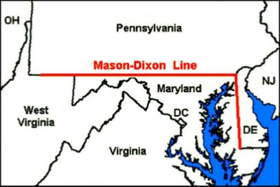 It was in 1763 that two English astronomers-
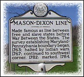 The work was held up for some six months during 1767, due to Indian resistance, and they were not able to complete the last 36 miles of the border. However, when they finished their survey in 1767, the official boundary stretched for some 244 miles. The line was resurveyed in 1849 and again in 1902 and was found to be remarkably accurate. Today, many of the original markers remain, but some have been put to better use as doorsteps! When erected, each one bore a P on one side and an M on the other, and every fifth one was engraved with the appropriate coat of arms. The total cost of the project was somewhere in the region of $75,000. Work on surveying the remaining stretch of the boundary was begun in 1782 and completed two years later.
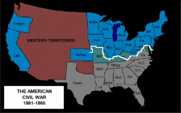 In the 19th century, this line -
xxxxxLittle is known about Mason and Dixon, but they had worked together before. In 1760 they had been appointed by the Royal Astronomical Society to go to Sumatra in order to observe the transit of Venus. It appears that, for some reason or other, they got no further than South Africa, and returned home from there.
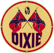 Incidentally, it is possible that the term "Dixie", the popular name for the American South, originated from the name "Dixon". It is more likely, however, that it derives from the French word for ten, because a few years before the outbreak of the American Civil War, the Citizens' Bank of Louisiana issued a $10 bill which had, on its reverse side, the word Dix. But there are other contenders! There might well have been a kind slave owner named "Dixie", because the black slaves used to sing a song about the good life at "Dixie's". Lastly, the name may have come from a song written in 1859 by the American composer Daniel Decatur Emmett (1815-
Acknowledgements
Map: (North America): licensed under Creative Commons – en.wikipedia.org. Map (United States): licensed under Creative Commons – https://tuckahoe.wikispaces.com.
G3a-
Including:
Charles Mason and
Jeremiah Dixon